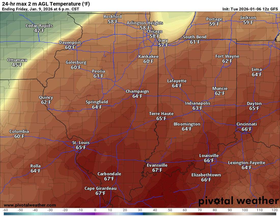
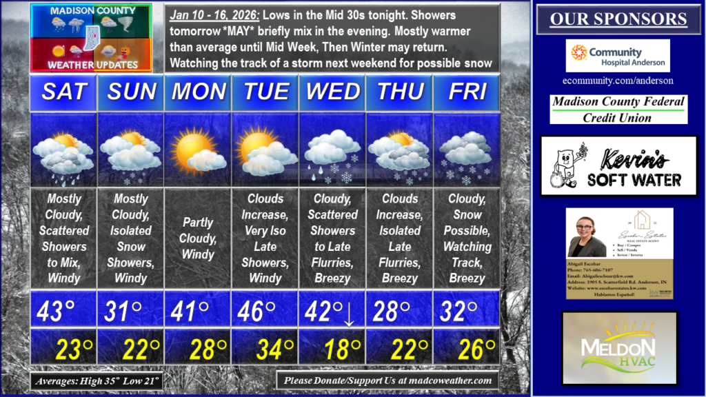
Today’s high of 62° occurred just after 1 AM. Lows in the Mid 30s tonight. Showers return tomorrow. If rain lingers late enough, it MAY briefly mix with snow in the evening. We’ll remain mostly warmer than average until Mid Next Week, Then Winter may return. Watching the track of a storm next weekend for possible accumulating snow. Right now, data has the snow path to our Southeast. However, the pattern indicates data should come Northwest over the next few days. We’ll see how things look early in the week. #MadCoWx #INwx
THANK YOU to those of you who are page Patrons, Subscribers, and Donors
and to the page’s Sponsors:
Madison County Federal Credit Union ( https://www.madcofcu.org/ )
Kevin’s Soft Water ( kevinswater.com )
Escobar Estates ( abigailescobar@kw.com )
Heavenly Hair Salon ( heavenlyhairsalonanderson.com )
Elwood Fire Equipment ( https://elwoodfireequipment.com/ )
Purseptions Boutique VIP ( https://www.facebook.com/groups/PurseptionsVIP/about/ )
Meldon HVAC ( https://www.meldonhvac.com )
Weightman Realty Group ( weightmanrealty@aol.com )
Community Hospital Anderson ( ecommunity.com/anderson )
Uranus Indiana ( https://www.facebook.com/UranusIndiana )
Joy Mitchell, Independent Scentsy Consultant ( https://joymitchell.scentsy.us/ )
Jack’s Pool Water ( https://www.facebook.com/jackswater )
7P HVAC ( https://www.facebook.com/people/7P-HVAC/100066566620059/ )